

Drop the hook in the Isles of Scilly, and chances are you’ll be anchored over a wreck, as Dick Durham reports
Following the discovery of wrecker’s DNA in his blood, the late novelist, John Fowles, became fascinated with the reefs that form the Scillies and which have sunk 1,000 ships. After visiting the Scillies’ notorious Western Rocks, he described them as ‘the most terrible 10 square miles in maritime history’, recalling the centuries’ long toll of square-rigged ships piling up in fog, gale and calm.
The last commercial ship to plough onto the rocks of Scilly, was the 3,000-tonne German freighter, Cita, in 1997, reportedly after the watch officer fell asleep. Today a YouTube video shows divers finning around her stricken hull, the only soundtrack is their regulators exhaling eerie breaths as pollock and wrasse look on with baleful stares.
For the hundreds of yachts which visit every year, the channels, rocks and reefs are now festooned with buoys, lighthouses and beacons, making a visit to one of the most interesting destinations in northern Europe, hazard-free. However, accidents still happen to the unwary. Like the charterers who came in on the Polbream, a Jeanneau Sun Odyssey 37 which, in 2010, ran aground on Kittern Rock and left her bolt-on keel behind in a crevice.
There’s something disturbingly alluring about looking at wrecks.
Many divers, I’m sure, do not consider the terrible consequences surrounding the circumstances of the loss, but in the Scillies where the very foundation of the islands economy has emanated from shipwreck, whether deliberate or not is a subject of debate and conjecture, when you’re surrounded by the rocks and reefs and history of the Scillies you can’t help being drawn into discovering more about what happened, sometimes hundreds of year ago.
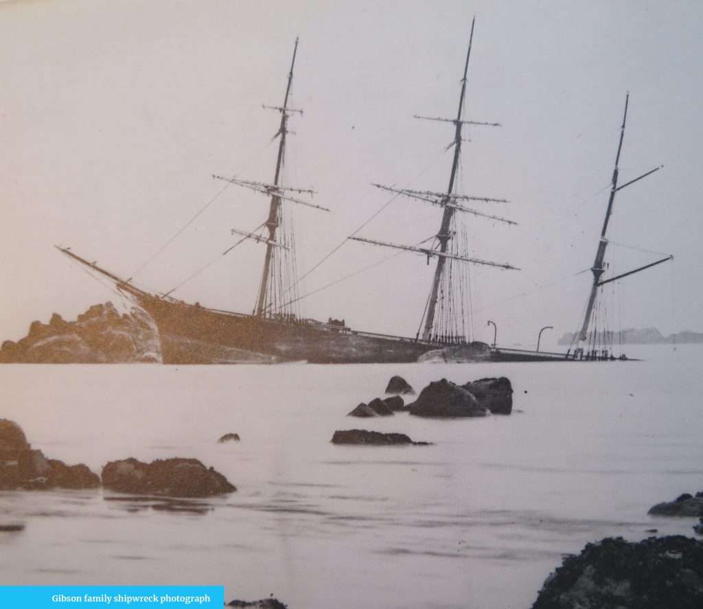
Ever since I’d gazed at the 19th century black and white photographs of tall ship’s piled up on the rocks of the Scillies, I had wanted to go to this historic maritime graveyard. So, when the chance came, I jumped at it.
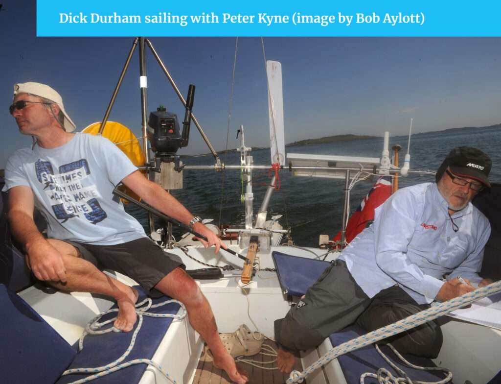
‘The rocks haven’t moved’, a laughing Peter Kyne tells Ocean Sailor as I check the latest changes to navigation in his home islands. Peter, a lobster-pot fisherman and yachtsman, compiled A Sailor’s Guide to the Isles of Scilly (available from Mumfords Paper Shop. Tel: 01720 422438).
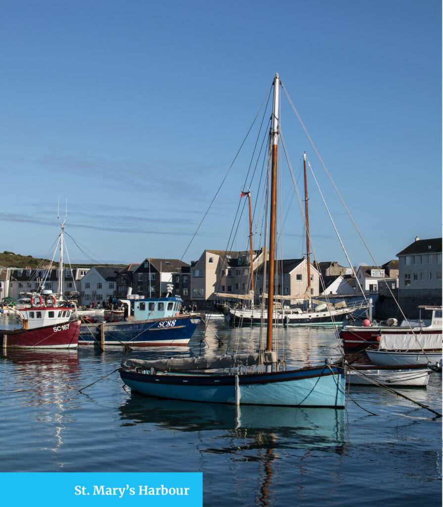

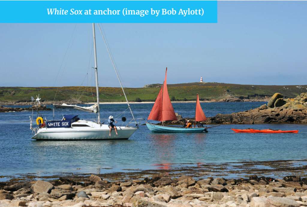
I joined him aboard White Sox, his Hunter Horizon 27 for a tour of the Scillies. Before setting off from his Hugh Town, St Mary’s home I noticed the wooden flooring was in all manner of different shades. When he collected this flotsam from the wreck of the Cita it was dark! In the time-honoured tradition, Peter had informed the Receiver of Wreck, as in UK waters all artefacts found underwater must be reported to Camilla Moore who holds this title, and so his flooring remains laid. From the same wreck another islander, a farmer, had filled his barn with salvaged golf bags. The manufacturer wanted them destroyed rather than have their name associated with soiled goods and because the Receiver of Wreck had been informed of the haul, the manufacturers were obliged to purchase them back from the farmer.
Peter’s wife, Sandra, is the great-great-granddaughter of John Gibson, a sailor who taught himself how to use a plate glass bellows camera and left the sea in 1866 to become a photographer. His haunting images of tall ships, sails still set, squatting on the rocks of his home islands can now be seen at the National Maritime Museum, Greenwich, London. ‘Shipowners were grateful for my family’s images as it gave them hard evidence for the insurance company’, Sandra said.
Scilly comprises five inhabited islands: St Mary’s, St Martin’s, St Agnes, Tresco, Bryher and around 70 others, plus any number of rocks. If there’s enough vegetation for a goat to survive a year’s grazing it’s an island, if not it’s a rock, is how the locals see it. Peter has been sailing and fishing around the Scillies for almost 30 years and I welcomed his experience as some of the short cuts he knows are not for the faint-hearted.
In a three-day cruise, starting from St Mary’s we sailed between Bryher and Tresco, where a transit which marks Lover’s Rock was temporarily unavailable. ‘A cow knocked over the further post,’ explained Peter nonchalantly.
He explained how TV celebrity, Anneka Rice, came to the islands with her Challenge Anneka programme to build a quay at Bryher, but Bryher defeated her and the job had to be finished by locals.
In New Grimsby Sound, Peter explained that the cannons on the battlements of King Charles Castle were too high for effective use on ships because the cannonballs rolled out of the barrels. ‘That’s why Cromwell’s Castle was built at sea level’, he mused.
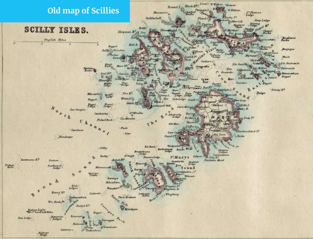
Rounding craggy Shipman’s Head put us briefly in the Atlantic before entering a bottleneck of reefs and negotiating a dogleg channel between Gweal Rock and Bryher. ‘I don’t include this passage in the book, as it’s best not to enter until you have some serious local knowledge’, said Peter. Not far to the north-west lies Scilly Rock where, in April 1910 the first-ever SOS message was transmitted from the SS Minnehaha, a passenger freighter on passage from New York to Tilbury, which foundered there.
Clearing Moon Rock we lined up a red-roofed barn and sailed into beautiful Great Porth Bay where we anchored for the first night. We took the inflatable ashore to a flour-white beach and walked through rust-coloured bracken and bursting mauve foxgloves as tall as a man.
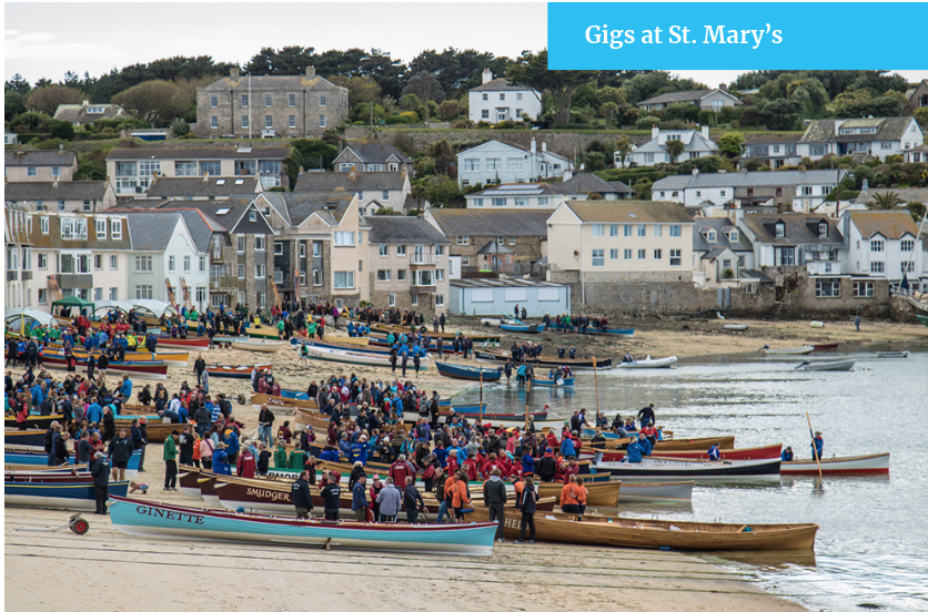
Out to sea we could hear the thwack, thwack as some rowers bent to the oars of a gig. The Scillies are famous for producing the finest small-boat handlers in the world. It was the gig men who rescued so many from the shipwrecks of yesteryear.
The next day we sailed out past Black Rocks to port and the mournful barking of seals sunning themselves on Scilly Rock to starboard. We passed between Castle Briar Rock and Illiswigig Rock and then breasted Mincario Rock where puffins swam so close we could have stroked them.
Ahead of us, the infamous Western Rocks looked like a fleet of sunken battleships in the early morning sunshine. I landed briefly on Great Crebawethan at the northern end of the reef and took in the ‘black-serried granite fangs that stretched away in all directions’, as John Fowles described them.
It was here that the Royal Navy suffered its worst disaster in peacetime: In 1707 when, without the benefit of longitude calculation or Bishop’s Rock (the UK’s tallest lighthouse), Admiral Sir Cloudesley-Shovell’s ship the Association, and the rest of his fleet piled up with the loss of 2,000 men.
‘Proportionate to their size, no islands in the world have a more lethal record than the Scillies’, Fowles penned.
We eased the sheets and cleared the fearfully-named Tearing Ledge, where another of Cloudesley-Shovell’s ships still lies. We sailed towards Annet, crowned with sea thrift, looking benign in the summer sun, but I should not have been fooled.
‘A seven-masted schooner, TW Lawson’s anchors failed here during a December hurricane in 1907 and she capsized in there’, Peter said as he pointed towards a ridge of black teeth. ‘Not many survived. The gigs went out to pick up bodies the next day’.
These isles are better suited to the storm petrel; the only location in England where they breed.
We had to reset the anchor at Porth Conger, St Agnes, as the increasing breeze caused White Sox to drag on the first attempt. She settled to anchor on the second attempt and when she was happily fast, we went ashore to the Turk’s Head pub for lunch.
Peter then sailed us eastward where we anchored in a cove at Little Arthur Rock before heading back to Hugh Town for the night.
On our third and final day, we sailed over St Martin’s Higher Ledge – during the equinox with high pressure it’s possible to walk between many of the isles – through Tean Sound and around the fearsome Lion Rock and into Porth Morgan behind White Island. Here we anchored in calm conditions while a stone’s throw away, on the eastern side of the island waves smashed onto the rocks. It’s a classic Scillies tactic; looking out for the weather shore.
Eight miles northeast lies the Seven Stones reef upon which the 61,000-ton oil tanker Torrey Canyon grounded in 1967 causing £3 million worth of damage. The then Prime Minister, Harold Wilson, who is buried on St Mary’s near his holiday bungalow, ordered the wreck to be bombed in a failed bid to burn the oil and halt the pollution.
Finally, Peter announced: ‘You’ve had enough of rocks, I’ll show you some sandy beaches instead’. Good as his word we sailed to Appletree Bay, Tresco and anchored for lunch.
Get your anchorages marked
St Mary’s Harbourmaster, Dale Clark, said Irish yachtsmen sail in from the north, French from the south and Dutch, Belgians and Brits from the east. He will look at your chart, take in the wind conditions and tidal range then mark the best places for your boat to anchor or moor.
Fuel
Available on Hugh Town Quay. Channel 12.
Visitor’s Buoys
Green buoys are for larger craft, yellow for smaller.
Tide Cycles
Peter says it’s convenient to think of the sea around Scilly as the face of a clock. Think of the tide as the hour hand; the flood starts at say 19.00 Low Water and moves clockwise until 01.00 High Water. Then it becomes the ebb and moves around until 07.00. He says it’s best for visiting yachtsmen to have more than one anchorage scoped out when they arrive and to also have a plan of both getting in and out. It’s also best practice to operate from half tide and rising.
10 Top Tips for cruising the Scillies
- Choose neap tides for your first visit: more depth in anchorages and weaker currents. By the time springs come on you’ll have the knowledge.
- Use an anchor trip line. Many power cables run between islands.
- Wear polarised sunglasses to see the bottom – the sun reflects off the sandy sea-bed.
- Don’t rely on sea breezes, there’s not enough landmass to heat up the ‘convection engine’.
- Be prepared to shift to a new anchorage. Keep a ready eye on wind direction.
- Anchoring is free throughout the isles so perfect your anchor drill.
- If a deep low is on the way make for Watermill Cove or St Helen’s Pool for shelter.
- Be prepared for a ground swell in heavy weather.
- Give way to tripper boats: their season is short and they are always grateful!
- Lobster pot lines are extra-long so that in heavy weather they can be retrieved at a safe distance from the reefs they sit on and to allow for the big tidal heights here.
The Magical Scilly Islands. A Land Lubbers view.
These mysterious islands, steeped in violent sailing history, captivated me long before I ever took to the sea professionally.
They lie, wind and wave-swept, 30 nm miles west out into the Atlantic off Land’s End from Cornwall, where I grew up.
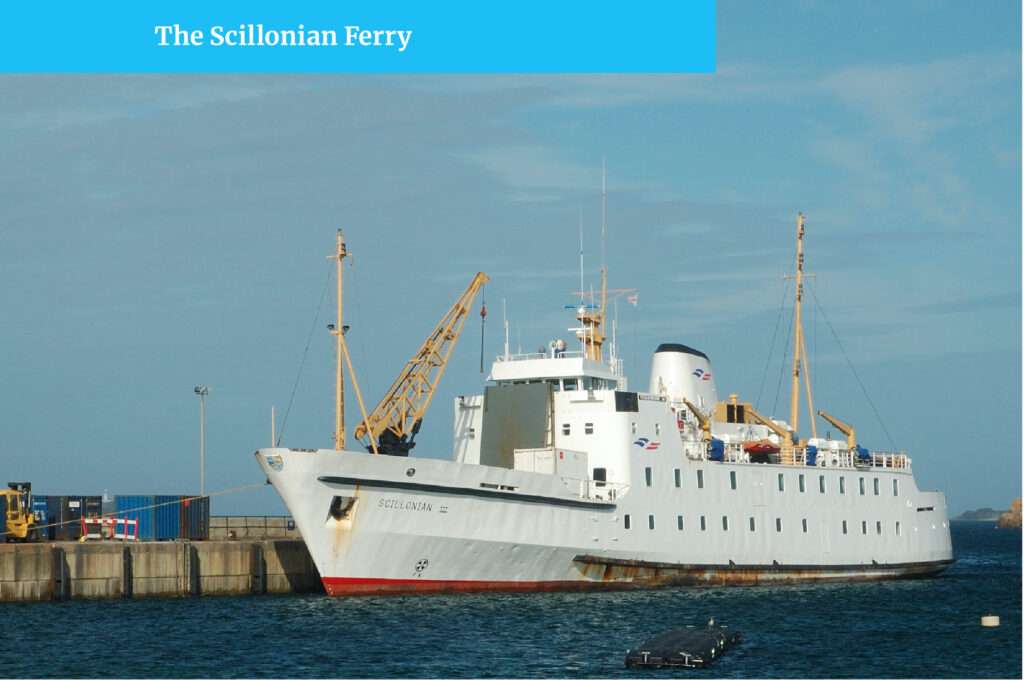
During my childhood in Cornwall, I was fortunate to make regular visits there on our family holidays and I have vivid memories of waking up early in the morning, driving down to Penzance in the dark ready to take the early morning Scillonian ferry. I remember the excitement as the islands hove into view, the golden sandy beaches and blue inviting waters
The Isles of Scilly lie in the Western Approaches about 30 miles off the South West tip of Cornwall and squat directly in the Gulf Stream. The islands enjoy a uniquely stable climate which rarely varies by more than 5°C throughout the year. As a result, over 20,000 plants from over 80 countries thrive here that would never sprout anywhere else in the British Isles. Each island has its own distinct character and with no cars apart from on the main island St. Mary’s, it is a tonic for lovers of peace and quiet.
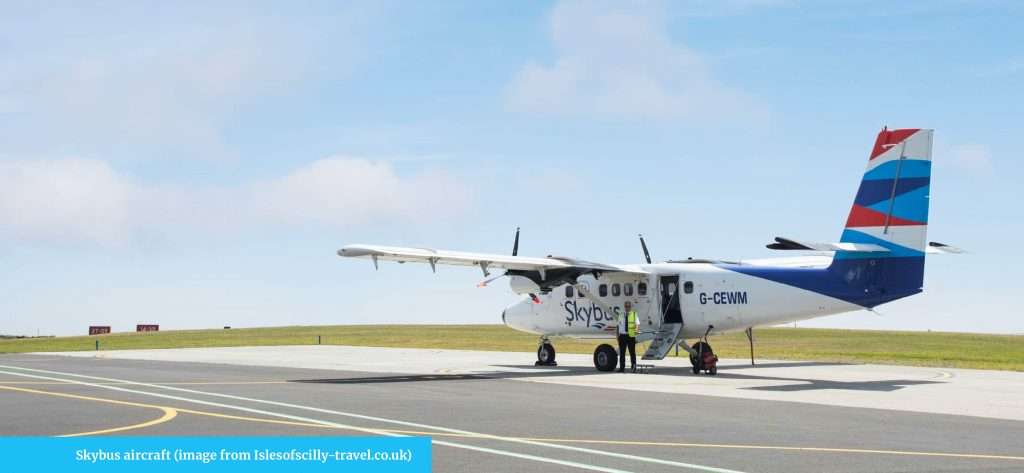
How do you get there if you are not sailing? The easiest way is a Skybus flight from Land’s End, Newquay or Exeter. Newquay and Exeter both have excellent connecting routes to the rest of the UK and a few parts of Europe. A helicopter is also an option from Penzance heliport to St. Mary’s airport or direct to Tresco. For those of you who wish to stay out of the clouds, the Scillonian ferry sails once a day, from March to November from Penzance Harbour.
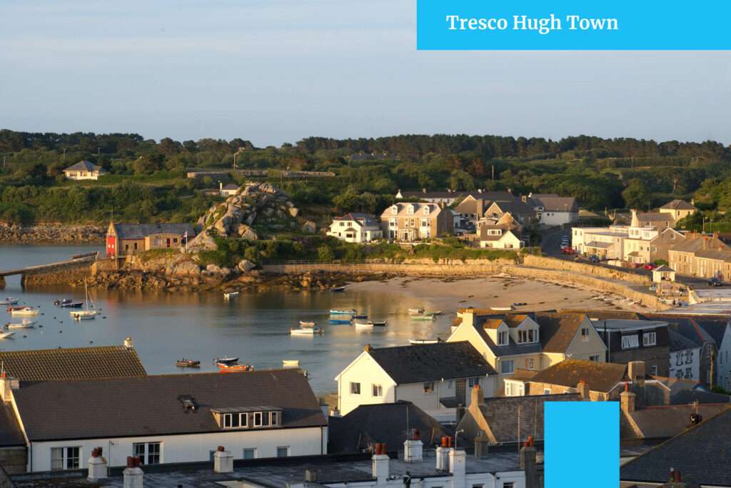
My favourite island, Tresco is flanked by Bryher to the west and St. Martin’s to the east, it is very well protected. It boasts a stunning subtropical climate on the south side but its northern end is bleak and unforgiving with rugged cliffs rising out of the Atlantic Ocean, similar to the South Cornish coast in many ways. It’s the second largest of the Scilly Isles, although still only 1.15 square miles in size. The walk around the island’s shore is truly enchanting.
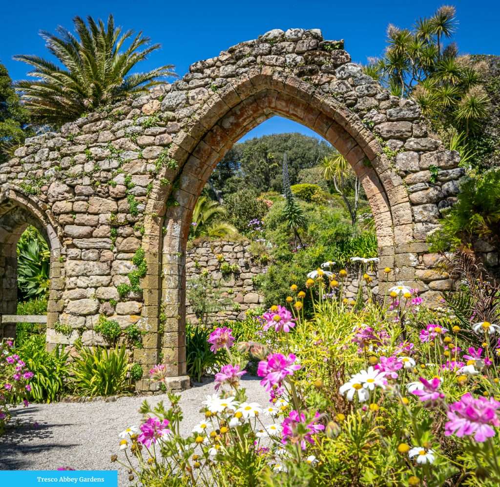
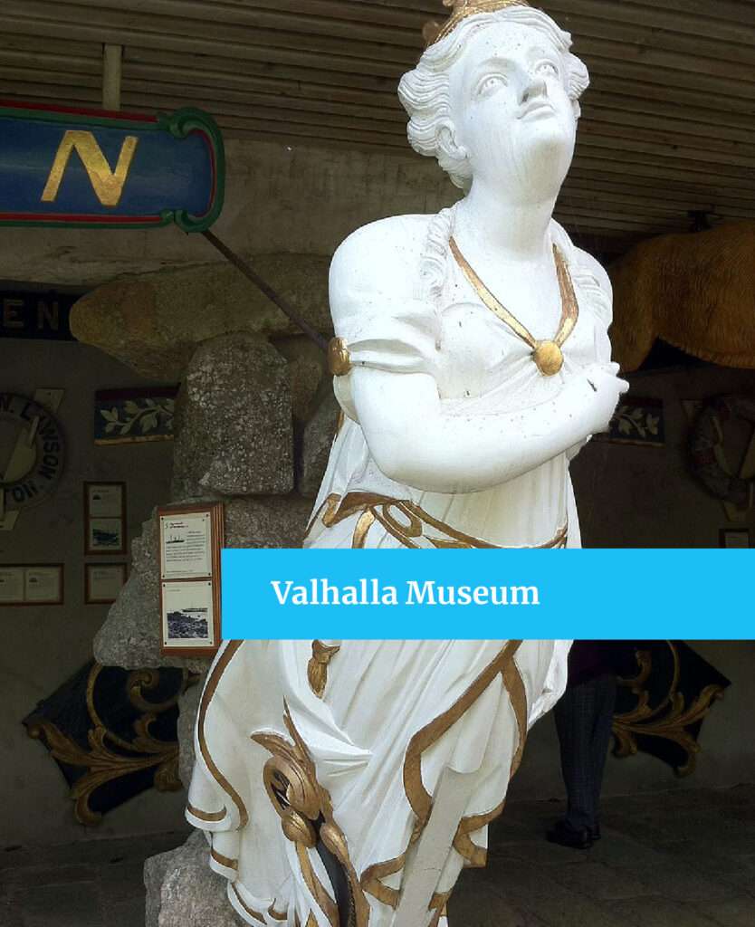
On the south side, you will find Tresco Abbey Gardens, home to thousands of tropical plant species and the Valhalla Museum, home to over 30 ships’ figureheads, all from the wrecks which the islands have claimed. Most of the figureheads are from mid to late 19th century and come from merchant ships or early steamships. The collection was started in 1840 by Augustus Smith, owner of Tresco Abbey and ‘Lord Proprietor’ of the islands.
I remember visiting the islands in 1997, not long after the Cita was wrecked. Perhaps I was even there at the same time as Dick B was diving there? See Dick’s article on diving the Scillies in next months Ocean Sailor.
The islands were buzzing with talk about the various items which were washing up on the islands. I remember my brother running the width of Bryher island looking for a matching size 11 left running shoe to go with the right one he had already salvaged. Each island seemed to have different items washing up, doors, household goods, clothing, with St. Agnes having the largest claim to Action Man clothing!