
Readers’ favourite Anchorages of the World
Showcasing your favourite anchorages.
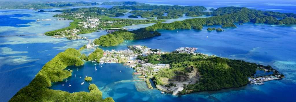
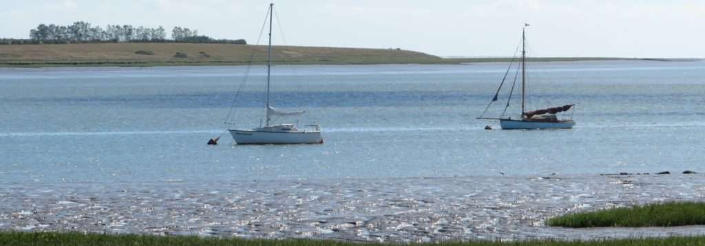
Malakal Harbour
From Kraken Yachts Creative Director Trystan Grace
Location: Malakal Harbour, Palau
Coordinates: 7°20.29’N 134°27.06’E
Seabed: Good holding in sand or mooring buoys
Protection: Well protected from all directions.


I will never forget the morning we approached Palau. The early morning rays and perfectly clear skies as we approached the reef that encircles the archipelago. There are three channels through the reef, one on the west side and two on the east. You will need to clear into Palau on the east side of the island. Information about the clearing process can be found on noonsite.com.
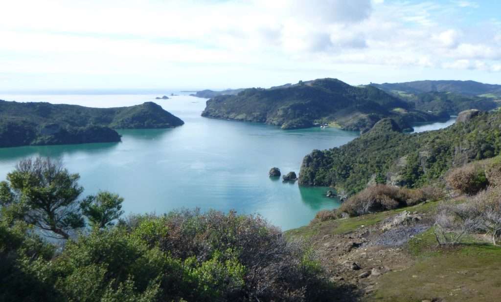
Once the formalities are over you will want to head back around to the west side of the island and Malakal Yacht Harbour. Being on a 65m yacht, we had to anchor in the channel outside of the harbour, however, normal sailing yachts can easily drop anchor in the naturally protected bay. There is a narrow buoyed channel through the reef (not shown on the chart) which always has a minimum of four meters of depth. In the gin-clear water it looks a lot shallower than it is, but if you’re nervous one of the helpful Sams Tours staff will guide you in. There is a small island and shipwreck which you should leave on your port side as you enter.
This is the home of the Royal Belau Yacht Club and Sam’s Tours (diving and adventure operator). There are visiting yacht mooring buoys available or you can anchor between the small island and the dock in about 15-18 meters of water.
Fuel is available at a shell fuel dock and The Bottom Time Bar offers excellent food and drink and is a perfect spot to take in a beautiful sunset over the anchorage. While here you simply must dive, as Palau has some of the best diving on the planet. The Blue Corner or German Channel were both stunning and the sheer amount of sea life, sharks, manta rays etc is astounding.
To the west of the yacht harbour is a series of ‘hurricane holes’ which offer a quieter hideaway experience and even more protection if a typhoon rolls in, but these do have some depth restrictions on entry.
The whole archipelago of Palau is a wondrous place from Jellyfish Lake, with hundreds of thousands of non-stinging jellyfish, to the island of Peleliu to the south, infamous for the battle of Peleliu in World War 2. Malakal Harbour is the perfect staging anchorage to base yourself from and it is also a beautiful anchorage in its own right.
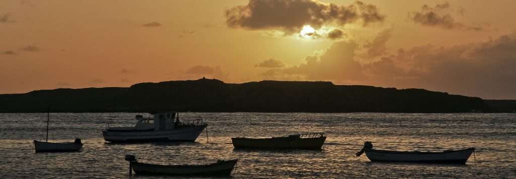
Sal Rei
From Sailing reader Marcin Sochaj
Location: Sal Rei, Boa Vista, Cape Verde
Coordinates: 16°9.93’N 22°55.11’W
Seabed: Sand over rock. Holding can be poor at places.
Protection: Protected from east and north, exposed to south and west. In heavy swell conditions could be uncomfortable or even dangerous.


Cape Verde is a reasonable stopover on the way from Europe to the Caribbean and South America. Although to check-in and take on water or fuel it’s necessary to call in Mindelo, or Palmeira, my favourite spot on the archipelago is Sal Rei on Boa Vista.
The third biggest island in Cape Verde, it looks like a piece of the Sahara desert that has been thrown into the Atlantic. It’s mostly flat, covered with sandy dunes and a few rocky hills.
There is an international airport, a couple of modern hotels and a sleepy town. Despite limited options, I managed to have two of my culinary “the mosts” there. The most delicious lobster in a shanty bar by the beach and the most disgusting rum in a small shop in town.
Anchorage is between the southern tip of Ilheu de Sai Rei and the sandy beach south of the town. The entrance is wide open to the west, with English Reef in the middle, which can be passed on both sides. The reef is visible in most weather as it is covered with breakers. It’s good to go as deep between islands as possible, as it is quieter in case of swell. Do not try to pass between the islands, a shallow rocky ledge connects the easternmost point of Ilheu de Sal Rei with the main island. The sand over rocks on the bottom is shifting constantly so the holding varies drastically with time and location. There is a dinghy dock at an old jetty by the town, 0,5 nm to the northeast, otherwise it’s possible to leave the dinghy on the beach and walk to the town.
Some boats anchor south of the new commercial harbour, between islands, but there is very limited space and in case of swell the entrance channel becomes dangerous.
Harty Ferry
From Ocean Sailor Editor Dick Durham
Location: Harty Ferry, East Swale, Kent, United Kingdom
Coordinates: 51°35.52’N 00°89.23’W
Seabed: Good holding in mud
Protection: Protected from all winds


Some years back I sat in the bar of the Ferry House Inn looking down on the isolated saltings and empty stretch of muddy water known as The Swale in the garden of England, aka Kent.
The vista before me seemed peaceful and yet brushed with a sense of eerie calm. The chatter in the busy bar was overwritten by the monologue of the landlady as she served pints to large men with shaved heads, who were either bikers, or prison officers from the Category A jails, of which there are three located on the Isle of Sheppey.
One evening at dusk she had witnessed a man with a sack over his shoulder wandering down onto the marshes. By closing time, mine host noticed, he had not returned so she called the ‘Old Bill’ as she called the police.
Officers arrived an hour or so later and after making a search of the marshes under torchlight discovered a man asleep in a trench he had dug in order to inter his hound’s carcass. After drinking a bottle of whisky he decided to spend a final night with his beloved pooch.
Harty Ferry is like that: a strange, brooding place that is sheltered from all winds but the north-easterly throwing up a nasty chop on the ebb tide which runs hard here. The holding is good in London boulder clay which will swallow all patent anchors and not let you retrieve them without copious gobbets of black mud, dripping from their flukes.
On the opposite side of the Swale is Faversham Creek which dries out, although on the flood tide you can row in to the Shipwright’s Arms, a weatherboard inn haunted by the ghost of a long dead barge skipper who was wrecked in a winter’s storm and who was found frozen to death on the doorstep in the morning.
The ferry itself – a large skiff rowed by the ferryman – stopped carrying farm workers across the Swale in 1941, ending almost 300 years of service. The stony hard on the south side still leads up between tall witheys to the sea wall where there is a fresh water spring to fill your beakers. On the north side a broken causeway sports the wooden winding gear once used by the ferryman.
You will never have less than 3m of water in the anchorage and your echo-sounder could be reading the depth from the bones of King Stephen whose remains were hurled into a nearby creek.
History throws a long shadow in these parts.
Please tell us your favourite anchorage and we’ll featured it in the next months ‘Dropping Anchor’. Send the anchorage details with a brief description of why you like this anchorage along with some photos showing the layout of the anchorage, plus the primary details: Location, coordinates, seabed type and protection.
Send your favourite anchorage to hello@oceansailormagazine.com